Property Record
851 Springfield Ave, New Providence, NJ 07974
NEARBY LISTINGS FOR SALE OR LEASE
-
-
View all New Providence listings for sale on LoopNet.com
Property Detail
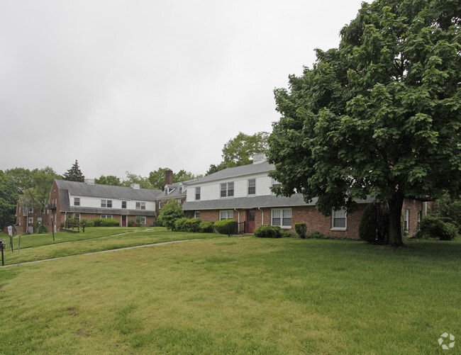
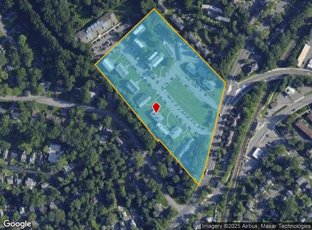
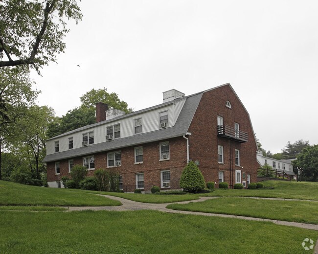
851 Springfield Ave
11-00103-0000-00022-01
Glenbrook
Apartment
Union
X
New Jersey
34039C0008F
22.1
2024
8.68 AC
2025
Western Union County
038103
Northern New Jersey
192 SF
Newark, NJ-PA
DEMOGRAPHICS near 851 Springfield Ave
1 Mile
3 Mile
5 Mile
2024 Total Population
12,339
76,353
193,581
2029 Population
12,193
76,178
192,770
Pop Growth 2024-2029
(1.18%)
(0.23%)
(0.42%)
Average Age
40
40
41
2024 Total Households
4,507
26,623
67,031
HH Growth 2024-2029
(1.66%)
(0.48%)
(0.58%)
Median Household Inc
$163,955
$179,962
$168,078
Avg Household Size
2.70
2.80
2.80
2024 Avg HH Vehicles
2.00
2.00
2.00
Median Home Value
$759,581
$827,308
$768,357
Median Year Built
1962
1959
1958
Nearby Places
Map Layers
Map Styles
 Street
 Aerial
- Restaurants
- Banks
- Shops
- Fitness
- Groceries
PUBLIC TRANSPORTATION
COMMUTER RAIL
New Providence (Morris & Essex Gladstone Branch - NJ Transit Commuter Rail (NJ Transit))
DRIVE
WALK
Distance
New Providence (Morris & Essex Gladstone Branch - NJ Transit Commuter Rail (NJ Transit))
1 min
4 min
0.2 mi
Murray Hill (Morris & Essex Gladstone Branch - NJ Transit Commuter Rail (NJ Transit))
DRIVE
WALK
Distance
Murray Hill (Morris & Essex Gladstone Branch - NJ Transit Commuter Rail (NJ Transit))
5 min
2.1 mi
AIRPORT
Newark Liberty International
DRIVE
WALK
Distance
Newark Liberty International
22 min
14.8 mi
LaGuardia
DRIVE
WALK
Distance
LaGuardia
57 min
34.1 mi
Freight Ports
Maher Terminal
DRIVE
WALK
Distance
Maher Terminal
25 min
15.3 mi
Nearby Properties
Address
Land Use
TOTAL SIZE
Lot Size
Zoning
Address
Land Use
TOTAL SIZE
Lot Size
Zoning
46.18 AC
Address
Land Use
TOTAL SIZE
Lot Size
Zoning
1,968 SF
88.85 AC
PROD
Address
Land Use
TOTAL SIZE
Lot Size
Zoning
Address
Land Use
TOTAL SIZE
Lot Size
Zoning
151,088 SF
26.48 AC
CCRC
Address
Land Use
TOTAL SIZE
Lot Size
Zoning
4,595 SF
4.57 AC
M-3
Address
Land Use
TOTAL SIZE
Lot Size
Zoning
7.19 AC
PI
Address
Land Use
TOTAL SIZE
Lot Size
Zoning
153.40 AC
OR
Address
Land Use
TOTAL SIZE
Lot Size
Zoning
4.30 AC
OR-3
Address
Land Use
TOTAL SIZE
Lot Size
Zoning
19.05 AC
R-2
Address
Land Use
TOTAL SIZE
Lot Size
Zoning
Address
Land Use
TOTAL SIZE
Lot Size
Zoning
439.33 AC
Address
Land Use
TOTAL SIZE
Lot Size
Zoning
296,578 SF
15 AC
Address
Land Use
TOTAL SIZE
Lot Size
Zoning
Address
Land Use
TOTAL SIZE
Lot Size
Zoning
0.42 AC
R-1
Address
Land Use
TOTAL SIZE
Lot Size
Zoning
Address
Land Use
TOTAL SIZE
Lot Size
Zoning
7.52 AC
OR-3
Address
Land Use
TOTAL SIZE
Lot Size
Zoning
144.37 AC
Address
Land Use
TOTAL SIZE
Lot Size
Zoning
140,732 SF
42.73 AC
OR
Address
Land Use
TOTAL SIZE
Lot Size
Zoning
9.44 AC
Address
Land Use
TOTAL SIZE
Lot Size
Zoning
22,488 SF
7.67 AC
Address
Land Use
TOTAL SIZE
Lot Size
Zoning
19.14 AC
Address
Land Use
TOTAL SIZE
Lot Size
Zoning
128.98 AC
Address
Land Use
TOTAL SIZE
Lot Size
Zoning
28.09 AC
R-3
Address
Land Use
TOTAL SIZE
Lot Size
Zoning
10.14 AC
R-2
Address
Land Use
TOTAL SIZE
Lot Size
Zoning
35.72 AC
PROD
Address
Land Use
TOTAL SIZE
Lot Size
Zoning
4.04 AC
B
Address
Land Use
TOTAL SIZE
Lot Size
Zoning
13,458 SF
33.40 AC
R-2
Address
Land Use
TOTAL SIZE
Lot Size
Zoning
12.90 AC
Address
Land Use
TOTAL SIZE
Lot Size
Zoning
8,676 SF
95.51 AC
R2B1
Address
Land Use
TOTAL SIZE
Lot Size
Zoning
7,046 SF
6.20 AC
G-1
The World's #1 Commercial Real Estate Marketplace
Connect with us
© 2026 CoStar Group
The information above has been obtained from sources believed reliable. While we do not doubt its accuracy we have not verified it and make no guarantee, warranty or representation about it. It is your responsibility to independently confirm its accuracy and completeness. Any projections, opinions, assumptions, or estimates used are for example only and do not represent the current or future performance of the property. The value of this transaction to you depends on tax and other factors which should be evaluated by your tax, financial, and legal advisors. You and your advisors should conduct a careful, independent investigation of the property to determine to your satisfaction the suitability of the property for your needs.